Image 1 of 7
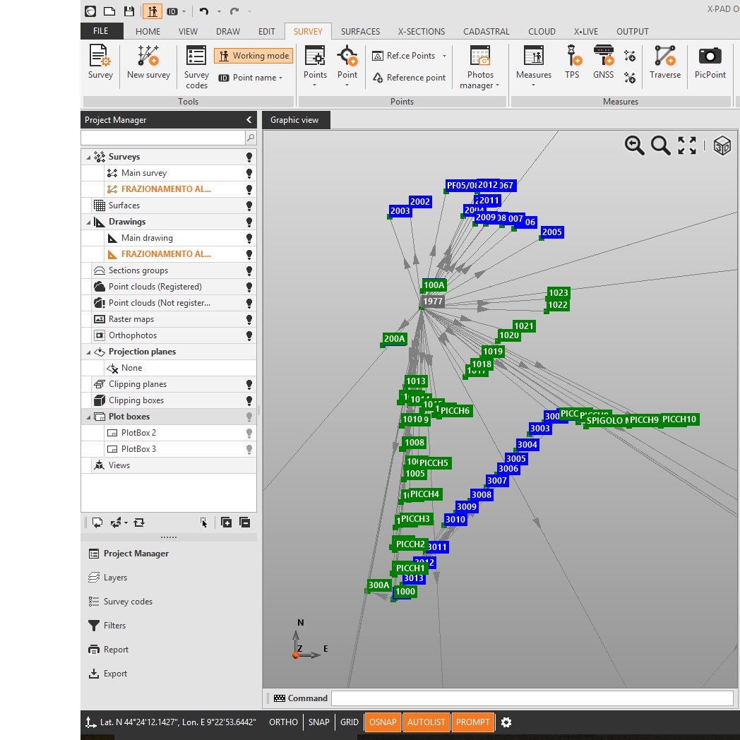 Image 2 of 7
 Image 3 of 7
 Image 4 of 7
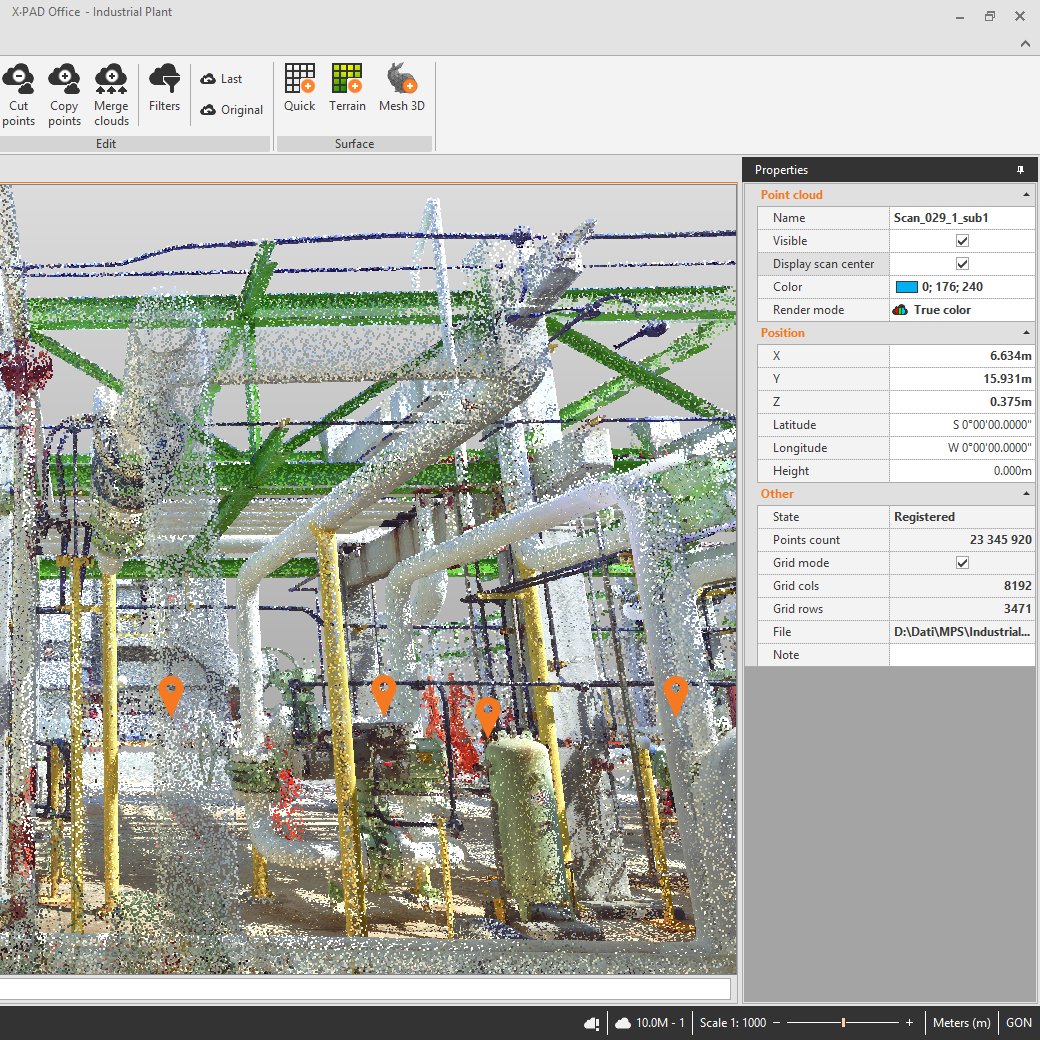 Image 5 of 7
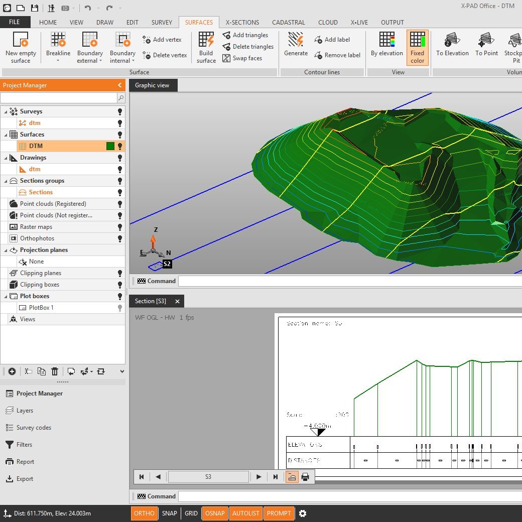 Image 6 of 7
 Image 7 of 7
GNSS Post-Processing Module
With the GNSS Post-Processing module, you can calculate GNSS static data. This simple workflow can be completed in three steps: import, set reference and rover observations and run the calculation. The calculated data can be stored and used for all other topographic operations inside X-PAD Fusion. As an additional option, the Post-Processing Advance module allows processing GNSS baselines with a least square adjustment algorithm to ensure the highest accuracy results.
X-PHOTO Image Processing Module
The X-PHOTO Image Processing Modules enable you to process images, generate point clouds and 3D surfaces quickly and accurately. For tasks like measuring a complex building, this module allows you to process mixed photos, aerial and terrestrial simultaneously, in a single step, to achieve the best results in the highest quality. The results are fully integrated into X-PAD Fusion’s main applications enabling you to create final drawings, maps and surfaces. Specific drawing utilities such as the Solid Orthophoto view and the possibility to select the coordinates in the original photos, ensures the user gets the most out of the calculated results.
X-SCAN Module
X-SCAN Module enables the management of point clouds data; robust algorithms are able to process point clouds and return the best results considering all the scans as a whole. Several features are designed to improve results and target recognition offers faster operation. An automatic registration module is an irreplaceable tool that generates the final results with one single click. Orthophoto, cross-sections and surfaces can be generated with very few and intuitive steps.
X-TOPO Module
X-TOPO Module enables you to import measurements from your instruments and have full control of all the information to verify quality; it calculates and solves all kinds of survey, GNSS, total station, digital level and mixed with the least squared algorithms for precise calculation. From topographic points or point clouds it is possible to create 3D models, contour lines, calculate cross-sections and volumes using several methods. Powerful tools and options allow you to customize the final drawings to obtain the best results possible for the user.
BIM Connect Module
Load and manage IFC files, extract elements for stake-out, and check as-built data with field measurements in the most efficient way.
X-PAD Office Fusion is a new concept of software for processing all types of geospatial data with real integration of different information: easy import of data, calculations, adjustments, scan registration and management of the clouds, points, measurements, surfaces and images, topographical utilities and drawing functions.