Image 1 of 1
GeoMax X-PAD Ultimate Features:
BIM
Within BIM, IFC files can be imported and displayed within CAD, survey, stakeout and COGO commands. Elements can be selected, hidden or isolated. From BIM models it is possible to extract points, lines, surfaces and cross-sections for stakeout and checking data.
Maps, WMS and Offline
X-PAD Ultimate allows users to access different map formats including Web Map Service (WMS) maps which can also be used off-line for when users are outside cell coverage.
Data Collections
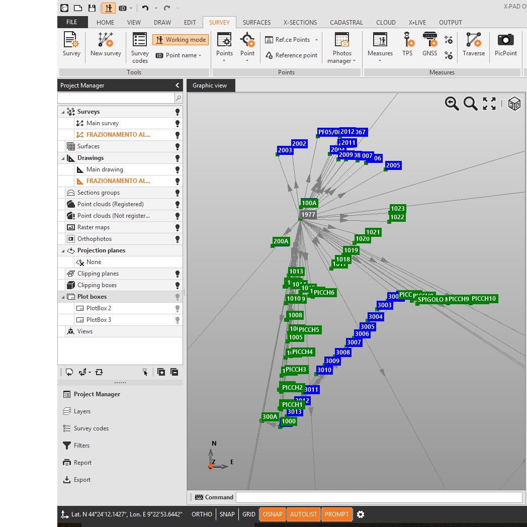
Measuring the position of the points is the main purpose to use the topographic equipment, but with X-PAD Ultimate you go further because you can integrate the position, photos and notes.
Quick Codes allow you to create your own custom panels with the most used codes and measure the position of the point automatically just after you choose the code.
Smartdrawing: Measuring and Drawing Together
This innovative automatic design system with survey codes allows you to see the survey drawing point after point without requiring lengthy and complex coding.
Stakeout: With your eyes closed
With X-PAD Ultimate, stakeout has never been easier or faster. Voice guidance allows you to arrive at the point without looking at the display, while the large compass simplifies visual navigation. Every drawing element including points, lines, arcs and position determined within the graphical view and can be stakedout.
Augmented Reality
Point the camera to the site and you can see immediately where the points and elements are for stakeout. X-PAD Ultimate will guide you in the vicinity of the point and then determine the exact location. You can also use augmented reality to visualise what is not physically there.
Voice Command
X-PAD Ultimate can be controlled by voice commands. You no longer need to touch the screen to set commands like measure points, change the survey code, the target type, etc.
GIS: Record all the information you want
The integrated GIS feature allows you to create and record GIS features and attributes corresponding to a specific point stored.
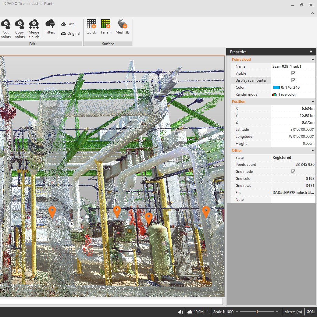
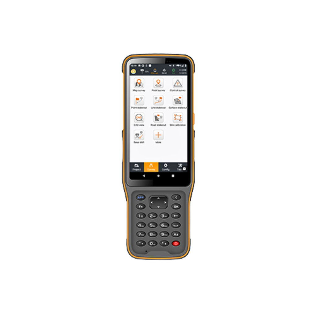
Topographic 3D CAD X-PAD Ultimate includes a real topographic 3D CAD, not just a simple graphic viewer with specific functions to draw, edit, measure and calculate the position of new elements which can be used in stakeout operations.Cloud and Sharing points: Field and office always connected
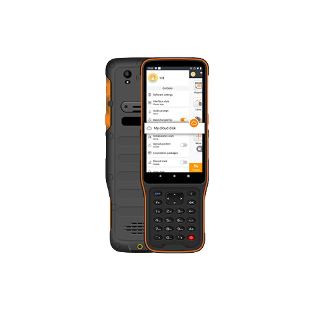
With X-PAD Ultimate you can open and import files, even if it is stored in the cloud. You can save your data on the most popular cloud platforms such as Google Drive, Microsoft OneDrive, Dropbox and access the data from the field or the office. You can also share information and coordinates of the measured points via a message or email and include images.
X-Pole: One Pole, Two Solutions
The X-Pole solution allows you to work simultaneously with TPS and GNSS using the best features of each system and with maximum flexibility. A simple click is all you need to change the measurement mode and switch from GNSS to TPS and vice versa.
Robotic Total Station
Robotic feature allows you to have full control of the robotic total station remotely. From a practical panel, you can access all the control functions of the station. In case of loss of the prism, it is possible to choose among different search strategies which are always available on screen.
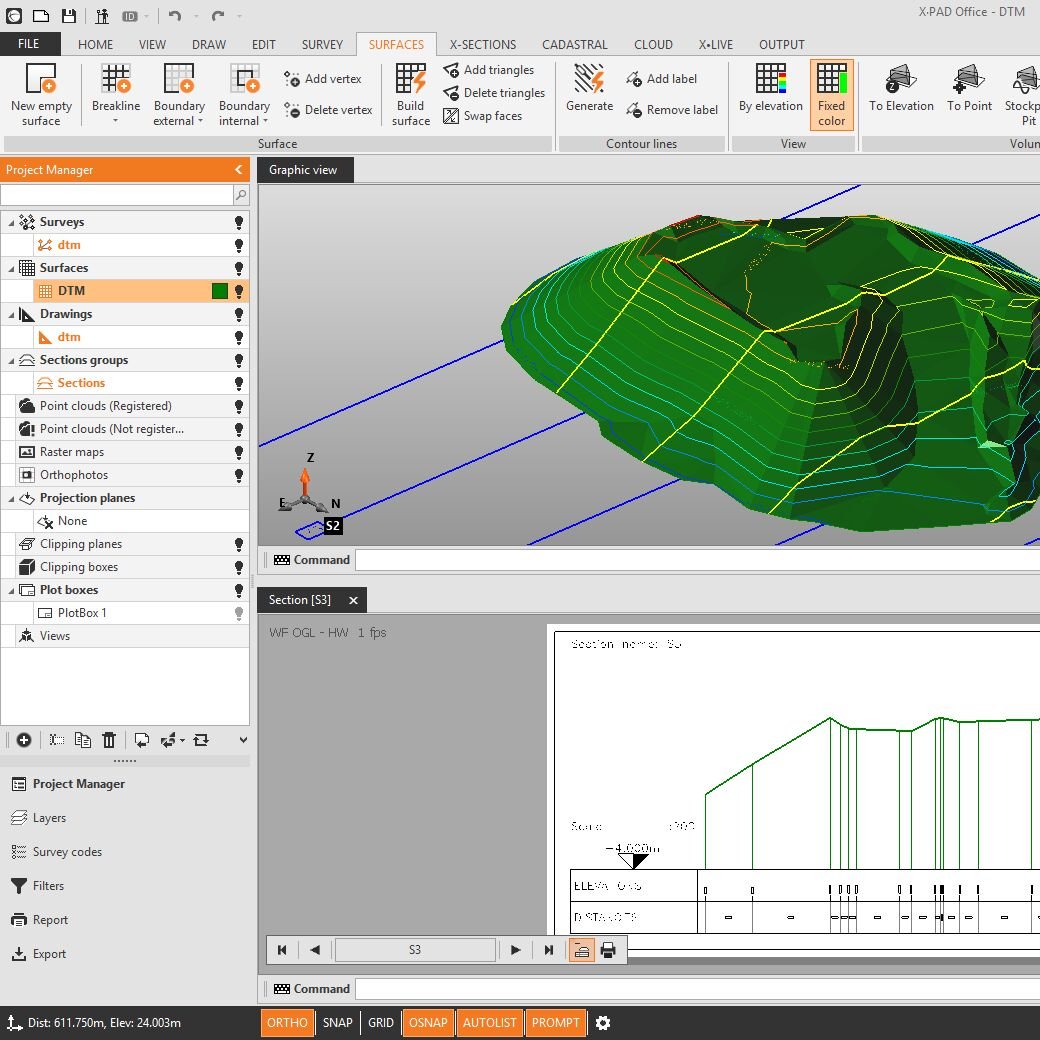
Terrain Surfaces and Volumes
Within the Volumes features, X-PAD Ultimate can calculate terrain models from the points with the options to define breaklines and boundaries. From the models, you can go to the volume calculation to determine at a glance the cubic metres of an excavation or of a pit/stockpile. You can also import DXF or LandXML files to stakeout.
Roading: The whole product in the field controller
The Roading feature allows you to load, manage and perform alignment stakeouts of works such as roads, highways and canals. The management is fully visual allowing you to see plans, vertical profiles and cross sections. You can stake all elements of the work (axes, edges, sideslopes, walls, ditches) at any station and with any offset, using the cross sections, the edge polylines or by defining one or more sections template.
Auto-measuring
Auto-measuring is a flexible, safe and economical solution for use of total station with automatic measurement. Just connect your total station with your Android device and get the real-time data via the web manager.
X-Pad Ultimate Survey
X-PAD Ultimate Survey is the best solution for professional surveyors that want accuracy, complete features, flexibility, data integration, scalability and the latest technologies in the field. With a set of different modules, X-PAD Ultimate Survey covers all the needs in the field using TPS and GNSS measure tools.
X-Pad Ultimate Build
The X-PAD Ultimate Build is the ideal solution for all your construction measuring and layout needs. The executing of all construction activities in an efficient and productive way. It combines data collection from TPS or GNSS, allowing you to perform the measurement, stakeout and as-built with simple and functional procedures.
X-PAD Ultimate Build is a special and tailored version of X-PAD Ultimate Survey, from which inherits all the main features and functionalities, but differs because it is specifically addressed to construction companies that can solve all measuring situations onsite in an autonomous and independent way, improving productivity and reducing costs. To use X-PAD Ultimate Build you don’t need to be a surveyor; all procedures are guided and user friendly.