
BuildMax Training Centre
Boost your knowledge as you learn from our expert team of qualified instructors with technical training courses designed to deliver professional development and key industry skills.

Introduction to GNSS Workflows
-
Importing Data
Co-Ordinate Systems and understand the reference network (SmartFix)
Surveying Data
Using design/drawing features
Setting out Data
Importing, editing, and using code libraries
Exporting Data
Full training notes and equipment supplied
-
Duration: ½ Day
Cost: $500
Who is this course for:
This entry-level course is designed for construction/survey industry professionals. who need to collect survey data competently and accurately, draw as-built designs with effective coding in the field.
-
Auckland

Introduction to Total Station Best Practice
-
Importing data sets
Understanding and using TPS orientation to backsight, known point & resection
Understanding control marks
Surveying data sets
Using design/drawing features
Setting out data
Importing, editing, and using code libraries
Exporting data
Full training notes and equipment supplied
-
Duration: ½ Day
Cost: $500
This entry-level course is designed for construction/survey industry professionals. who need to collect survey data competently and accurately, draw as-built designs with effective coding in the field, while understanding TPS orientation and export data sets.
-
Auckland

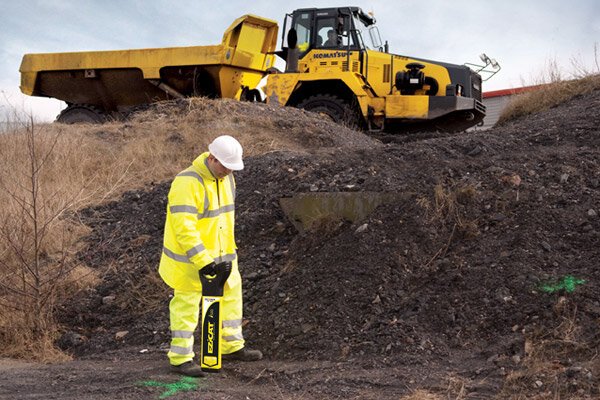
Introduction to Utility Detection
-
Utility location guidelines
Understanding the theory of utility location
How to undertake a visual site inspection
Utility detection best practice
Identifying passive, active, non-conductive, and direct connection underground utilities
Grid mapping techniques
Ground marking guidelines
Full training notes and equipment supplied
-
Duration: ½ Day
Cost: $500
This course is an introduction to underground utility locating, detection and avoidance and is designed for construction professionals tasked with ensuring utilities are accurately identified and mapped.
-
Auckland
Capturing Data to LINZ Utility Location Standard
-
Using and understanding the standard
How to integrate the standard into your location capture workflows What is TM 2000
What is vertical datum 16
How to find Survey Marks & to get TM2000 coordinates
How to ensure the data is collected to the required accuracy standards
Using and understanding the limits of positioning technology (This includes GPS/GNSS &Total stations)
Office based training
No Survey Equipment needed
Please bring calculator
-
Duration: 1 Day
Cost: $1,500
This course provides a detailed understanding of the new framework released by LINZ in relation to the new utility location accuracy standards. It outlines the accuracy requirements of asset collection when digitally mapping utilities.
-
Auckland

Introduction to Utility mapping with GNSS
-
Utility location guidelines
Understanding the theory of utility location
How to undertake a visual site inspection
Utility detection best practice
Identifying passive, active, non-conductive, and direct connection underground utilities
Grid mapping techniques
Ground marking guidelines
Create new projects with X-Pad for mapping
Co-Ordinate Systems and understand the reference network (SmartFix)
Surveying utilities using GNSS
Using drawing features
Importing, editing, and using code libraries
Exporting Data
Full training notes and equipment supplied
-
Duration: 1 Day
Cost: $1,000
This intermediate-level course is designed for construction/survey professionals using a cable locator with GNSS to accurately locate, identify and map underground utilities.
-
Auckland