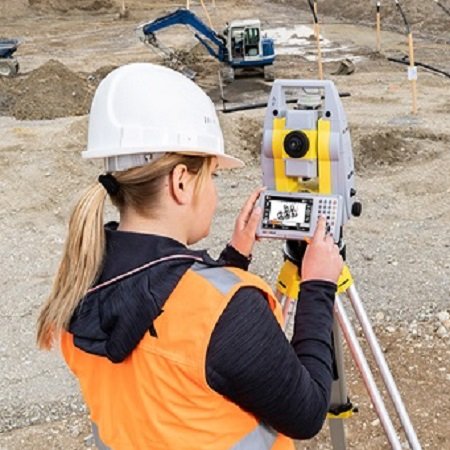


GeoMax Zoom30 Pro
The GeoMax ZOOM30 Pro manual total station offers integration with survey apps and the convenience of a colour touchscreen and Bluetooth connectivity.
Every GeoMax ZOOM30 Pro manual total station instrument comes with a complete range of powerful survey applications. From survey and stake-out to CoGo and volume calculations, the Zoom30 has an application to get every job done.
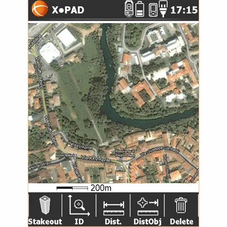
X-Pad software compatible
2″, 3″, 5″, 7″ accuracy options
400 metre or 600 metre reflectorless range
NavLight option
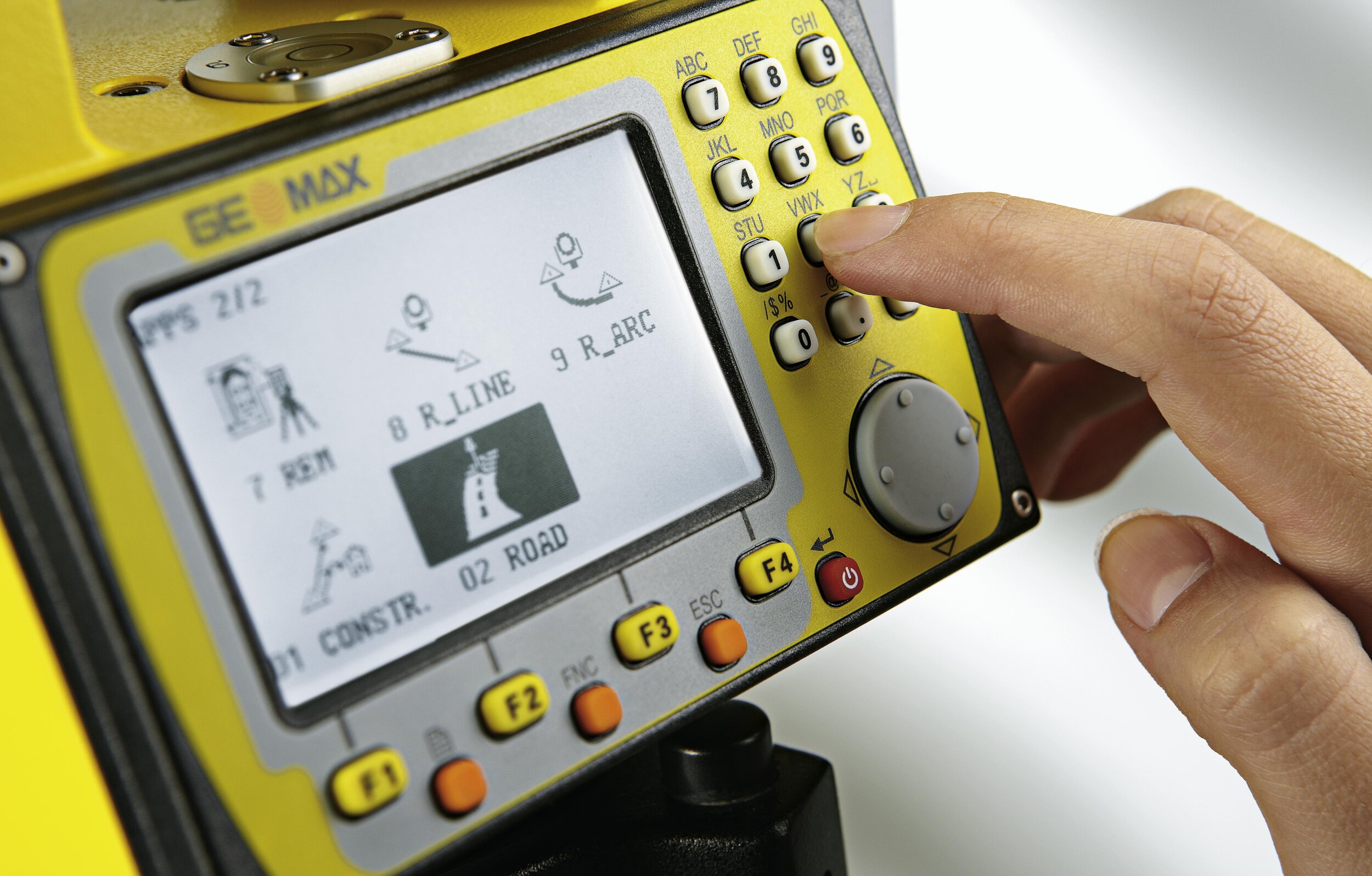
3.5″ Colour touchscreen
10 – line display
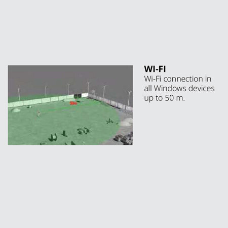
Bluetooth connectivity
laser plummet
full suite of standard survey Apps, including road design, area & volume calculations
dedicated graphical construction layout
co-axial visible laser beam
USB port for data transfer
PC software
on-board storage – 50,000 points
long life Li-Ion battery (up to 36 hours)
quadruple-axis compensation provides maximum reliability in both horizontal and vertical angles
designed in Switzerland and manufactured by GeoMax
Check our GeoMax manual total stations comparison chart here!
The GeoMax ZOOM30 Pro manual total station offers integration with survey apps and the convenience of a colour touchscreen and Bluetooth connectivity.
Every GeoMax ZOOM30 Pro manual total station instrument comes with a complete range of powerful survey applications. From survey and stake-out to CoGo and volume calculations, the Zoom30 has an application to get every job done.
X-Pad software compatible
2″, 3″, 5″, 7″ accuracy options
400 metre or 600 metre reflectorless range
NavLight option
3.5″ Colour touchscreen
10 – line display
Bluetooth connectivity
laser plummet
full suite of standard survey Apps, including road design, area & volume calculations
dedicated graphical construction layout
co-axial visible laser beam
USB port for data transfer
PC software
on-board storage – 50,000 points
long life Li-Ion battery (up to 36 hours)
quadruple-axis compensation provides maximum reliability in both horizontal and vertical angles
designed in Switzerland and manufactured by GeoMax
Check our GeoMax manual total stations comparison chart here!
GeoMax ZOOM30 Pro Manual Total Station
FEATURES:
Survey
Combine the GeoMax ZOOM30 Pro with the powerful survey App enables you to collect data quickly and accurately. Flexible coding and display formats deliver data the way you want it. Directly export surveys with codes into CAD.
Set-up with Resection
With the simple push of a key, your station coordinates and orientation are calculated and surveying can begin immediately.
Set Out
With precise, easy-to-follow guidance you’ll can quickly measure a point and move on to the next one.
Area (3D) & Volume
The area (3D) and volume app determines the area, volume and perimeter of the plan and slope surfaces at the push of a button.
Remote Elevation
The Remote Height application allows you to easily determine the height of a point when you cannot measure a distance to the point directly. The height of the remote point is automatically computed.
Construction
With large graphical displays, the staking of your construction site has never been so easy. You’ll complete construction stakeouts easier and faster than ever before.
Reference Element
Regardless of whether you’re staking or checking a reference line or arc, you’ll be amazed at the flexibility.
CoGo Routines
Easily calculate and determine points out in the field with the CoGo App. This powerful App allows you to calculate inverse, intersection, offset and line extension in a few easy steps.
Missing Line Measurement
Determine the distance, grade, azimuth and height difference between any two points. Determining ties is a breeze.
Two Prism Offset
Situations arise when you cannot measure a point directly. With Two Prism Offset, simply place one end of the rod on the hidden point and measure to both reflectors. The coordinates of the hidden point are automatically computed.
SPECIFICATIONS:
Angle measurements
Accuracy options – 2”, 3”, 5”, 7”
Display resolution – 1” (0.1 mgon)
Method – Absolute, continuous, diametrical
Compensation – Quadruple axis
Reflectorless Distance
accXess4 – 400 m reflectorless
accXess6 – 600 m reflectorless
Distance Measuring
Prism – 3,500 m / 2 mm + 2 ppm
Reflectorless – 3 mm + 2 ppm Footprint – 8 x 20 mm
Interface
Keyboard – Full alphanumeric
Display – 3.5” Quarter-VGA colour touch screen (320 x 240 pixel), 10 lines x 30 characters, illuminated
Data recording – Internal memory 50,000 pts
Interface – USB, serial & external power
Removable memory – USB memory stick
Power supply
Internal battery – Removable Li-Ion 4.4 Ah / 7.4 V
Operating time – 36 h (continuous angle), 9 hours (continuous distance measurement every 30 s)
Plummet
Type – Laser point, adjustable brightness
Accuracy – 1.5 mm at 1.5 m instrument height
Software
WINDOWS – Embedded CE
Physical Specifications
Weight – 5.1 kg (incl. battery & tribrach)
Operating temp. – – 20°C to +50°C (Optional tested polar version – 30°C to +50°C)
Protection class – IP55 dust- and waterproof rating
Humidity – 95 %, non-condensing