A guide to getting started with the GeoMax Network Rover Solution
These notes will cover:
How to set a co-ordinate system within X-Pad Ultimate
To complete the above procedures, the following equipment is needed.
Zenith 16/40/60 Network Rover Package
Field Controller with X-Pad Software
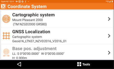
How to set a Co-ordinate System
From the home screen in X-Pad Tap Co-ordinate system
Tap Cartographic System
Select Yes to set a predefined system
Select the dropdown arrow of the user group to find New Zealand
Select the system (Mount Pleasant 2000)
Tap Accept
Tap the next icon
Select the NZVD Geoid (Geoid LTN)
Co-ordinate system will now be set in terms of Christchurch